
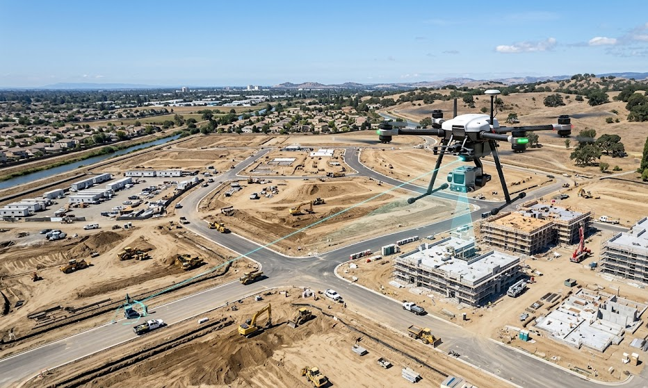
Aerial survey services have changed dramatically in Australia over the past decade, largely thanks to drone technology. What once required expensive aircraft, long mobilization times, and complex scheduling can now be accomplished with smaller, faster, and more cost-effective systems. For government agencies, engineering firms and construction businesses, drones offer a practical way to collect accurate geographic data, monitor progress, and respond to land and infrastructure challenges—often with reduced disruption and improved efficiency.
Why Drone-Based Aerial Surveys Are Growing in Australia
Australia’s large land area and diverse terrain create real surveying challenges. Remote regions, long distances between sites, and harsh environmental conditions mean that aerial information can be difficult or costly to obtain. Drones help bridge this gap by enabling data capture close to the ground, with flexible flight planning and rapid turnaround times. They are also useful for sites where access is limited, such as bushland areas, coastal zones, construction sites behind temporary fences, and active operational areas within industrial facilities.
Another reason for growth is the increasing demand for high-quality spatial data. Modern land development and asset management depend on mapping, measurements, and visual evidence for planning and compliance. Drone surveys provide orthomosaic maps, digital surface models, and 3D reconstructions that support decision-making across many sectors.
What Drone Technology Can Deliver
Aerial survey services with drone technology typically focus on accuracy, repeatability, and deliverables that can be used in engineering workflows. Most drone survey systems can be configured with high-resolution cameras and sensors, allowing operators to capture imagery suitable for photogrammetry and mapping.
Common outputs include:
- Orthomosaic maps: High-resolution, georeferenced maps stitched from overlapping images. These are useful for measurement, planning, and visual communication.
- Digital Surface Models (DSMs) and Digital Terrain Models (DTMs): These models represent the earth’s surface and can support volume calculations, grading assessments, and change detection.
- 3D models and point clouds: Dense data sets support detailed inspection, modeling, and documentation of complex sites such as quarries, bridges, stockpiles, and building facades.
- Progress monitoring imagery: For construction and infrastructure projects, drones can document changes over time—helping teams track progress, identify issues early, and report to stakeholders.
In many cases, survey-grade results depend not only on the drone, but also on the workflow: flight planning, image overlap, ground control points (GCPs), calibration practices, and proper georeferencing. When those steps are handled correctly, the outputs can be trusted for design and reporting.
Key Use Cases Across Australian Industries
Construction and infrastructure
Drones are increasingly used to map sites, verify earthworks, monitor building progress, and support safety management. Teams can compare “before” and “after” conditions, producing evidence-based reports for approvals and contractor coordination.
Mining and resources
For mining operations, aerial surveys assist with stockpile measurement, site layout checks, tailings monitoring, and operational planning. Drones can operate with lower mobilization costs than traditional aircraft, which is valuable for remote operations.
Agriculture and land management
In agriculture, drone imagery supports crop monitoring, soil analysis, drainage assessment, and water management planning. By identifying variability across paddocks, farmers can improve irrigation decisions and target interventions more efficiently.
Environmental monitoring and coastal mapping
Australia’s coastlines, waterways, and sensitive ecosystems benefit from repeatable aerial data collection. Drone surveys can help track erosion patterns, vegetation health, sediment movement, and the impacts of extreme weather events.
Choosing the Right Aerial Survey Partner
To get reliable results, it’s important to select a provider with experience in surveying workflows—not just drone operation. Key selection criteria include:
- Proven capability with photogrammetry and geospatial deliverables
- Demonstrated accuracy management and georeferencing methods
- Experience with similar projects in Australian conditions
- Clear deliverables format (GIS-compatible outputs, reports, and models)
- A focus on safety, compliance, and risk planning
For organizations planning a new land development, infrastructure project, or ongoing asset monitoring program, a well-structured drone survey can become an essential tool for long-term planning.
Conclusion
As industries continue to adopt data-driven workflows, drone surveys will likely play an even stronger role in helping Australian organizations make better decisions with confidence. For best results, partner with a professional drone survey team that can manage compliance, data accuracy, and deliverables from capture to final reporting.