
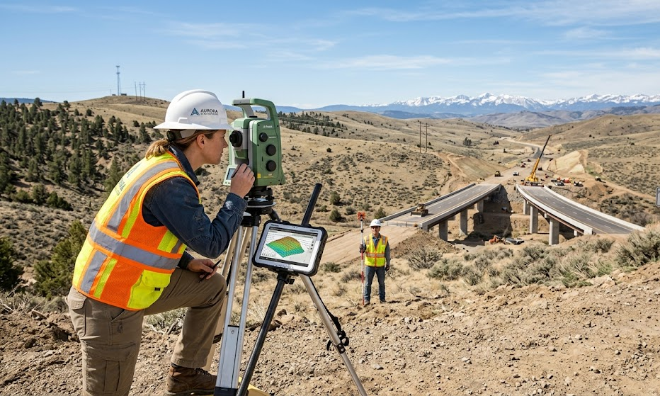
Engineering surveying is an essential component of infrastructure projects, playing a vital role in ensuring precision and accuracy. This discipline combines traditional techniques with advanced technology, enabling the effective planning, design, and execution of construction projects. As urbanization accelerates, mastering surveying techniques has become indispensable for delivering sustainable infrastructure solutions.
Understanding topography in engineering surveying
The term topography refers to the detailed mapping of the Earth’s surface and is fundamental to engineering surveying. It provides critical insights into the physical characteristics of a site, including elevations, landforms, and natural features. A thorough understanding of topography is essential for making informed decisions during the design phase of projects.
Analyzing terrain for better project outcomes
Analyzing terrain through arpentage involves collecting data on land features and organizing that information for planning purposes. Engineers and architects depend on this data to make strategic decisions, aligning their designs with the site’s natural characteristics. This approach minimizes unexpected challenges during construction, thereby reducing costs and ensuring project feasibility.
Utilizing advanced instruments for precise measurements
The use of sophisticated measuring instruments has revolutionized engineering surveying. Modern tools enable surveyors to achieve unprecedented accuracy in their measurements, which is crucial for infrastructure projects. These instruments include total stations, GPS units, and 3D scanners, all of which enhance the precision of data collection and analysis.
Exploring the benefits of 3D modeling
Employing 3D modeling techniques allows surveyors to create a comprehensive representation of the terrain and project features. This digital model not only aids in visualizing project designs but also facilitates effective communication between engineering teams and stakeholders. By identifying potential issues early in the planning process, 3D modeling helps avoid costly modifications during construction.
Integrating geodetic reference systems for accuracy
Implementing geodetic reference frames is critical for ensuring the accuracy of survey data across different projects. These reference systems offer a standardized framework for measuring distances and angles on the Earth’s surface. Knowledge of geodetic principles is paramount for surveyors, especially in large-scale infrastructure projects where discrepancies in measurements can have severe consequences.
Establishing reliable benchmarks
Setting up reliable benchmarks is a fundamental practice in engineering surveying. These control points act as references for all subsequent measurements and construction phases. Ensuring the stability and accuracy of these benchmarks is vital to maintaining the integrity of the entire project.
Collaborating with stakeholders for successful projects
Successful engineering surveying requires strong collaboration among various stakeholders, including architects, contractors, and local authorities. By fostering open communication, all parties can align their objectives and contribute to the project’s success. This collaborative effort allows for the seamless integration of surveying data into the overall project planning.
Facilitating the permitting process
Engaging all relevant stakeholders early in the project ensures that everyone understands the surveying results and their implications. This transparency simplifies the permitting process and can expedite approvals needed for construction. A proactive approach in addressing concerns and incorporating feedback fosters trust and cooperation, which are essential for navigating complex regulatory environments.
Implementing sustainable practices in surveying
In light of growing environmental concerns, incorporating sustainable practices in engineering surveying is becoming increasingly important. Environmental impact assessments and sustainable land management techniques help ensure that infrastructure projects minimize their ecological footprint. Employing eco-conscious surveying methods aligns projects with modern sustainability goals and community expectations.
Utilizing technology for green solutions
Leveraging cutting-edge technologies can facilitate more sustainable surveying practices. For instance, using drones for aerial surveys reduces the need for extensive ground disturbance, leading to less environmental degradation. Additionally, GIS (Geographic Information Systems) can help in analyzing land use and planning, contributing to more efficient resource management.
Final thoughts on the future of engineering surveying
As infrastructure demands grow, the role of engineering surveying will continue to expand. The integration of advanced technology and sustainable practices will shape the future of this discipline, ensuring its relevance in modern construction projects. Surveyors must stay abreast of industry trends to adapt and deliver innovative solutions that meet evolving needs.